Patterdale Skyline Challenge
Patterdale Skyline - 8 peaks in 8 hours!
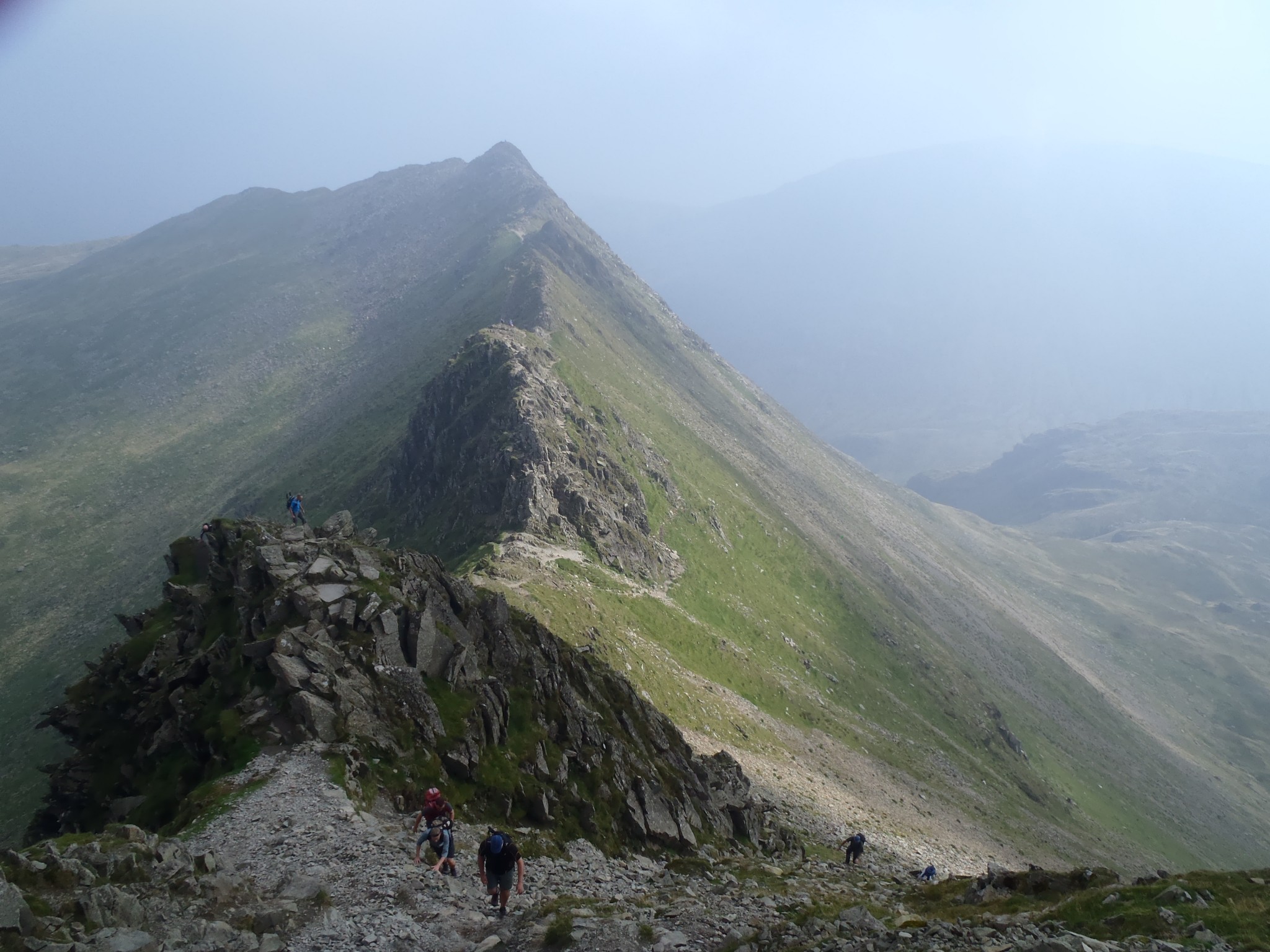
The Patterdale Skyline offers an opportunity to complete a superb ridge traverse over some of the most well known and grandest of the North Eastern fells including the 3rd highest Lakeland summit of Helvellyn at 950m above sea level.
Guidance; this Skyline route represents the medium level of challenge for a one day challenge, and is suitable for mixed ability groups who have completed a good degree of training prior to the challenge and have a good level of fitness, though previous mountain experience is not essential as the technical demands of this route are moderate. We can expect to be walking for around 8 hours on this challenge and you can expect to be exposed to the very best and worst of Lake District weather usually on the same day! But can expect to be rewarded by completing an inspiring and grand high level traverse.
Accommodation and places to eat and drink including toilets are available in Glenridding and Patterdale villages and onward transport to and from the M6 motorway (Jn 40) at Penrith, and mainline train station in the town itself is approximately 35 minutes.
We recommend that in the lead-up to this challenge, participants work on building up their stamina with weekly cardio-vascular exercise of a minimum of 1 hour per day, 5 days per week to build up their calf + quad muscles. It would also be beneficial to do at least one training walk if possible on broken rough terrain walking for at least 8 hours. From an average fitness start point it is likely you will need to commit to a 3-4 month fitness training programme to maximise your chance of success. We can help you prepare for this event – for information about our pre-selection / training day click here.
Itinerary
Arrival day
Check into your accommodation in Glenridding or Patterdale followed by early evening team briefing. Alternatively, we can arrange transfers from Penrith Rail Station.
Second day - Walking
We begin our ascent from the village of Glen ridding on the picturesque shores of Ullswater. From here we make our ascent up the Greenside valley traversing through the old mining landscape of Greenside mines before weaving through to the mountain pass of Sticks Pass, now at 750m above sea level. From here we turn left and the real ridge walking begins on our gradual ascent towards Helvellyn. We tick off our summits in quick succession, starting with the summit tower of Raise at 883m, then on to Whiteside (863m) and then wind up the narrower ridge of Lower Man (925m) with commanding views on a clear day across to the shapely pyramid summit of Catstye Cam (890m), a feast of rock and steep slopes surrounding you on all sides to satisfy the senses.
As we rise over the crest of Lower Man onto the Helvellyn plateau, the ground opens out and we are often met by a good gust of wind to welcome us to this wider mountain scape. You definitely begin to feel the sense of scale of this mountain range as you reach the trig point of Helvellyn (950m) and peer down the towering North and East faces with views to Striding and Swirral Edges and a glimpse of Ullswater down below in the distance. On a clear day, you can now expect to enjoy panoramic views of the Lakes as you continue your traverse, and in difficult conditions a real challenge to remember! We continue high but flatter now across to Nethermost Pike (891m) and Dollywagon Pike (858m) before making our descent in zig zags to Grisedale Tarn, a wild and windswept mountain lake, some 550m above sea level. From here the tone of the walk changes a little, as we make a more technical and rocky ascent of Fairfield (873m) via Cofa Pike. This will give us the chance to do a short ‘out and back’ route to gain the summit where we can use our hands and feet to make progress with some enjoyable and airy scrambling, weaving up through the boulders, scree and rock towers to the top. After reversing our route from Fairfield, we’re on the homeward stretch across the narrow saddle of Deepdale Hause and up to the final summit, St Sunday Crag at 841m to complete our 8 peaks route. From here we’ll enjoy the long but gradual descent back to valley floor for a well-earned rest and bite to eat and drink in the village at the base of our circuit.
Distance 21.2km, Ascent 1620m, Descent 1620m, Target time 8 hours. Terrain – rough mountain paths and undulating ridges.
Duration: 1 Day
Activities: Walking
Suitable for: Charity fundraising and/or team building groups
Comments: A medium level challenge suitable for mixed ability groups with limited or no prior mountain walking experience.
Prices from: £275
Call: 017687 75337
Booking Enquiry

Package Prices
Standard
Guest House – bed & breakfast + packed lunch
15% off Cotswold voucher
Head torches and Trekking poles included
Price is per person
Budget
Hostel – bed & breakfast + packed lunch
15% off Cotswold voucher
Head torches and Trekking poles included
Price is per person
Premium
Hotel – bed & breakfast + packed lunch
15% off Cotswold voucher
Head torches and Trekking poles included
Price is per person